Staff from the Historical Society of Princeton partnered with Sustainable Princeton’s Walk ‘n Roll Challenge to highlight local historical monuments that are within walking and biking distance of town. Follow along this route to explore five incredible destinations that tell Princeton’s history!
Route:
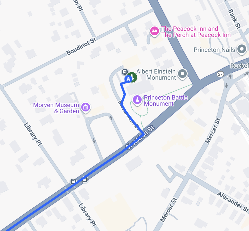
1. Monument Hall, 1 Monument Drive
The Princeton Battle Monument, commissioned in 1908, commemorates the 1777 Battle of Princeton, with depictions of George Washington and General Hugh Mercer. Designed by the famous Beaux-Arts sculptor Frederick MacMonnies and dedicated by U.S. President Warren Harding in 1922, the monument is a prominent feature of downtown Princeton. The surrounding gardens have been an ongoing revitalization project by Sustainable Princeton, and are now a bespoke design with entirely native species.
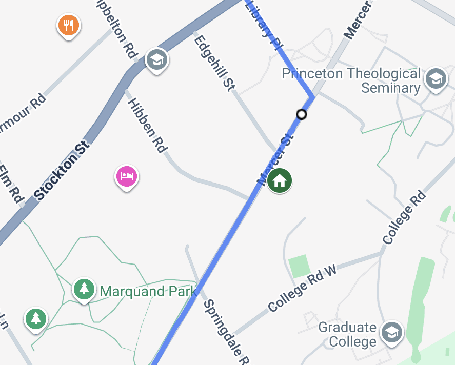
2. Einstein’s House, 112 Mercer Street
Albert Einstein achieved international fame for his theory of relativity and advances in the physics world. After the Nazis came to power in 1933, Einstein settled in Princeton to join the Institute for Advanced Study. He lived at 112 Mercer Street from 1936 until his death in 1955. The house, built around 1840 and moved from Alexander Street around 1875, remains a private residence today.
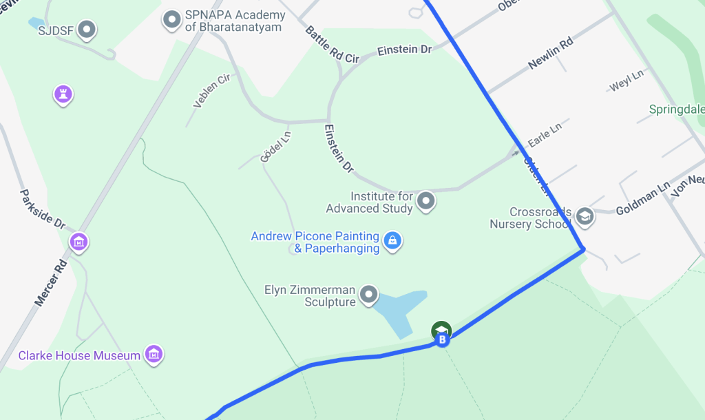
3. Institute Woods / Institute for Advanced Study, 1 Einstein Drive
The Institute for Advanced Study was founded in 1930 by philanthropists Louis Bamberger and Caroline Bamberger Fuld, with Abraham Flexner as its first director. The Institute was designed to give scholars complete freedom to pursue original research without prescribed goals or pressure for immediate results. It quickly became a haven for intellectuals fleeing facism in Europe during the 1930s. Notable scholars include Albert Einstein, Oswald Veblen, Kurt Gödel, Hetty Goldman, and Director J. Robert Oppenheimer.
The Institute Woods encompasses nearly 550 acres of preserved forest, wetlands, and farmland owned by the Institute for Advanced Study. Much of this land was acquired between 1936 and 1945 through the efforts of mathematician Oswald Veblen, who envisioned the Woods as a place for both intellectual pursuit and connection with nature. Protected since 1997 through a New Jersey Green Acres easement, the Woods are ecologically rich and historically resonant, serving as a stopover point for migrating birds and a habitat for native species of trees and herbaceous plants.
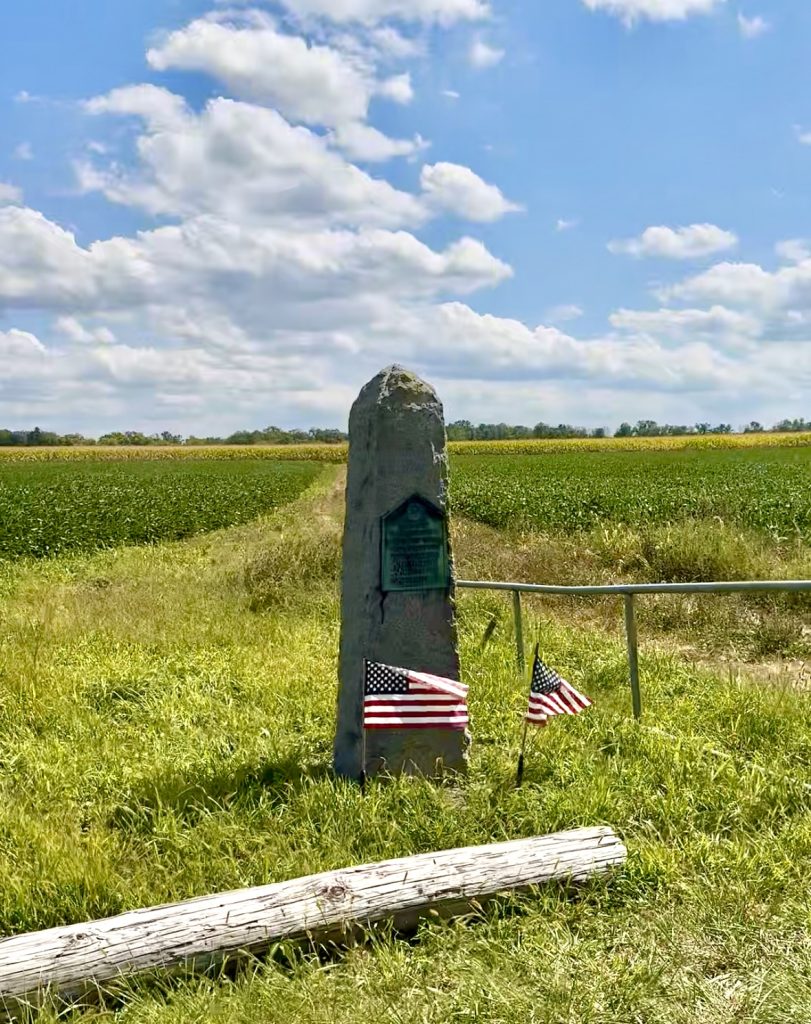
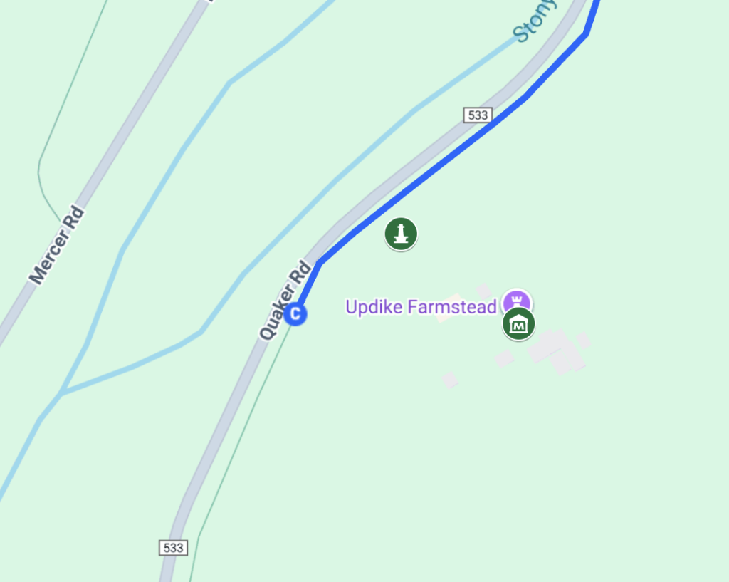
4. Obelisk marking the Route of Washington’s March, Quaker Road
The obelisk by the Updike Farmstead reads “Route of Washington’s march by night from Trenton to Princeton and victory January 3, 1777.” It is one of twelve markers erected along the route by the Sons of the American Revolution in 1914.
See map below for location.
5. Updike Farmstead, 354 Quaker Road
Updike Farmstead, headquarters of the Historical Society of Princeton, has been home to their museum and offices since 2017. The six acres that now form the Farmstead were originally part of a 1200-acre tract purchased in 1696 by Benjamin Clarke, one of the area’s earliest European colonists. In 1892, George Furman Updike, Sr., purchased the 190-acre property, which remained in his family for generations. In 1969, the Updikes sold most of the acreage to the Institute for Advanced Study. Today, a conservation easement ensures the land remains open space, with the fields still farmed. The Historical Society of Princeton acquired the Farmstead directly from the Updike family in 2004.
Thanks to everyone who participated in the Walk ‘n Roll Challenge this month! We encourage everyone to keep moving beyond the challenge and explore Princeton.